
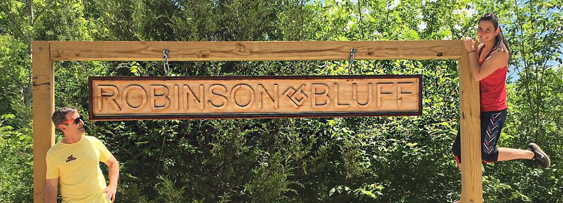
Directions to Robinson Bluff
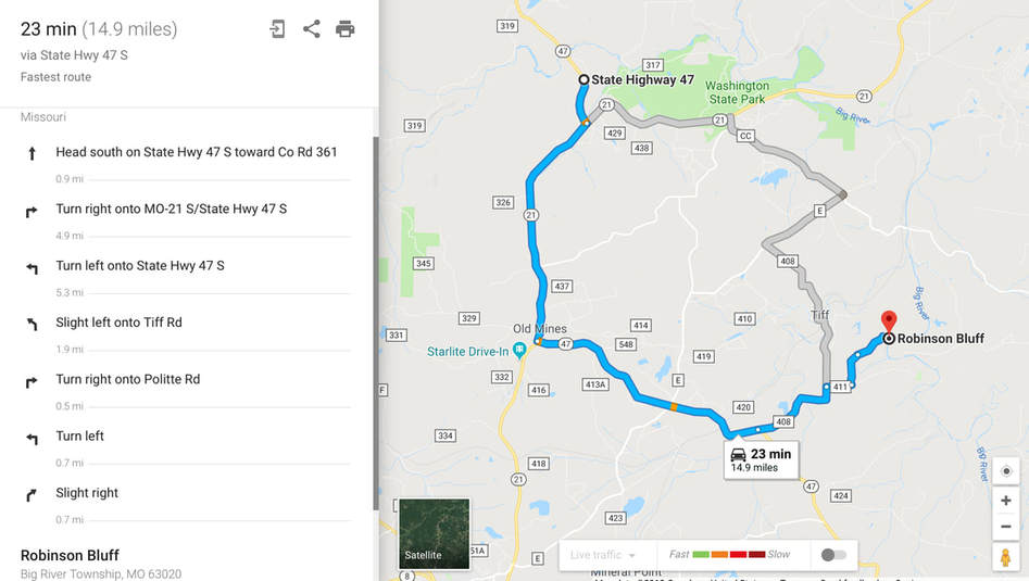
To get to Robinson Bluff, use the directions below, which take you through Tiff, Missouri. Directions from DeSoto are outlined below and our landmarks menu can help reassure your travel.
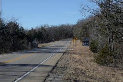
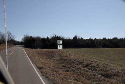
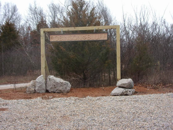
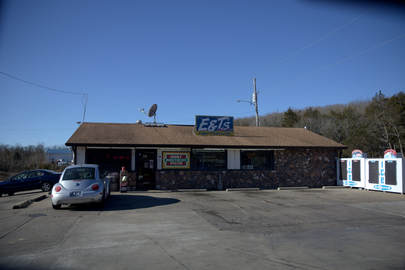
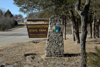
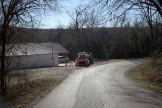
From DeSoto MO: Take HWY 21 south for 13 miles. Pass Washington State Park on your right and E&T’s service station on your left. Turn left onto Hwy CC. After 2.9 miles, turn right onto Hwy E. After 1.9 miles, turn left onto Tiff Road, which is easy to miss coming around a long curve. Follow Tiff Road past a small Tiff post office, under the railroad tracks, over the low water crossing, and up a long hill. After 3.6 miles on Tiff Rd, turn left onto Politte Road. Once on the gravel road drive a short distance and turn left onto Bo Hollow Road before the road changes to Dickinson Road (a paved road). After a mile, turn right into the obvious parking lot on your right.
- WARNING: If you plug the GPS coordinates into Google or Apple Maps, you'll likely end up across the river from the bluff and will have to double back. Please do not attempt to enter private property. Robinson Bluff is not accessible via the farm across the river.
- WARNING: If any roads are covered with water, DO NOT CROSS! Please take our SAFE ALTERNATIVE ROUTE listed below.
From DeSoto MO: Take HWY 21 south for 13 miles. Pass Washington State Park on your right and E&T’s service station on your left. Turn left onto Hwy CC. After 2.9 miles, turn right onto Hwy E. After 1.9 miles, turn left onto Tiff Road, which is easy to miss coming around a long curve. Follow Tiff Road past a small Tiff post office, under the railroad tracks, over the low water crossing, and up a long hill. After 3.6 miles on Tiff Rd, turn left onto Politte Road. Once on the gravel road drive a short distance and turn left onto Bo Hollow Road before the road changes to Dickinson Road (a paved road). After a mile, turn right into the obvious parking lot on your right.
|
|
Take HWY 21 south for 13 miles.
pass Washington State Park on your right and E&T’s service station on your left.
Take HWY 21 south for 13 miles. You will pass Washington State Park on your right and E&T’s service station on your left. About 0.5 mile past E&T’s turn left on to HWY CC and continue for 2.9 miles
Turn right onto HWY E and continue 1.9 miles
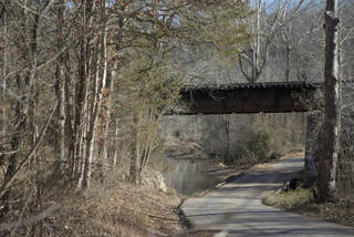
Turn left onto Tiff Road and continue for 3.6 miles.
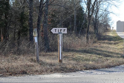
At the post office, stay left at the fork then go under a railroad bridge.
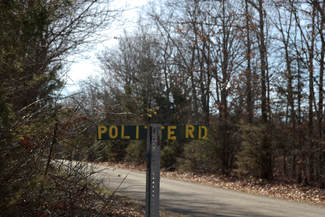
Turn left onto Politte Road and continue for 0.4 miles. (Politte Road turns into Dickinson road 100 yards after BO Hollow Road)
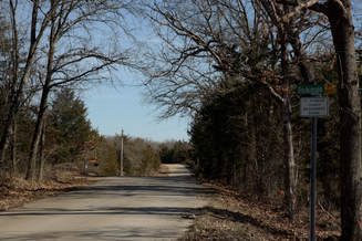
Turn left onto BO Hollow Road and continue 1.1 miles to Robinson Bluff parking on the right!
|
Flood & Alternate Route
Still Lost? Call: (314) 258-0250