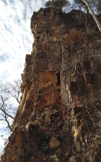
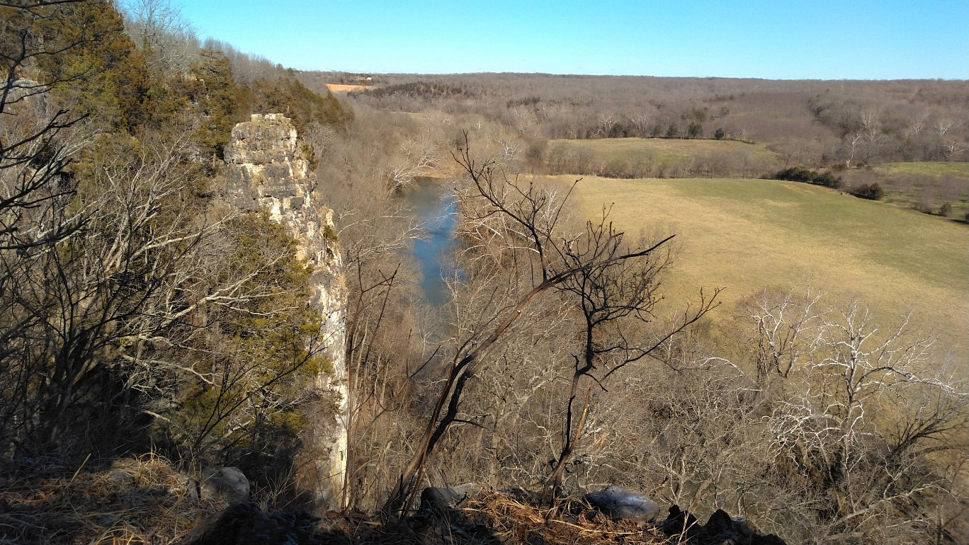
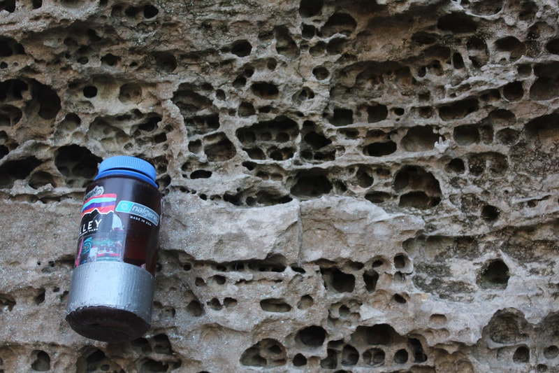
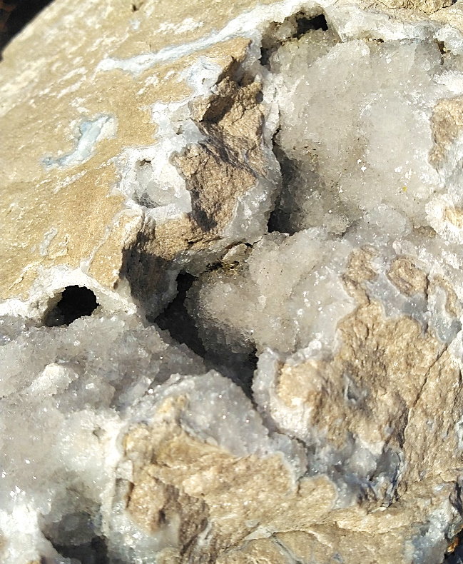
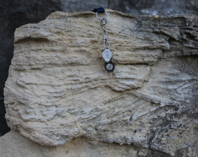
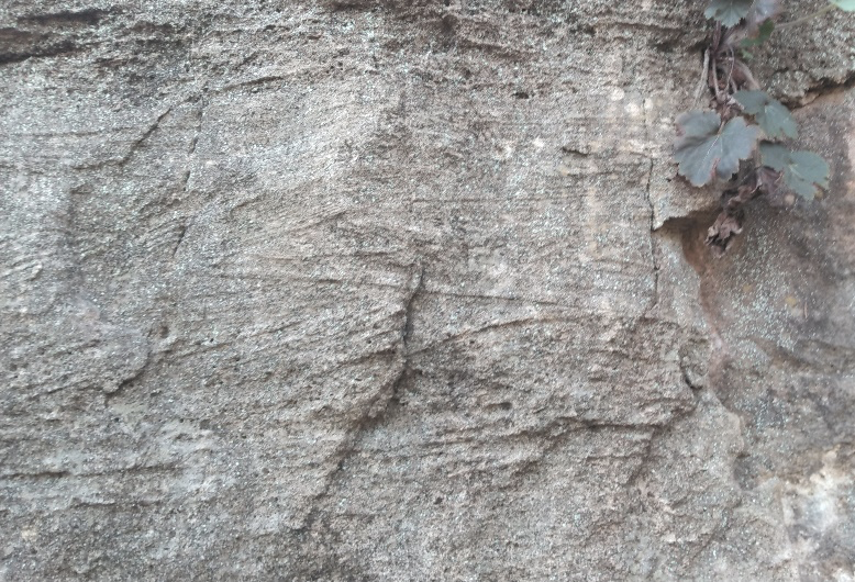
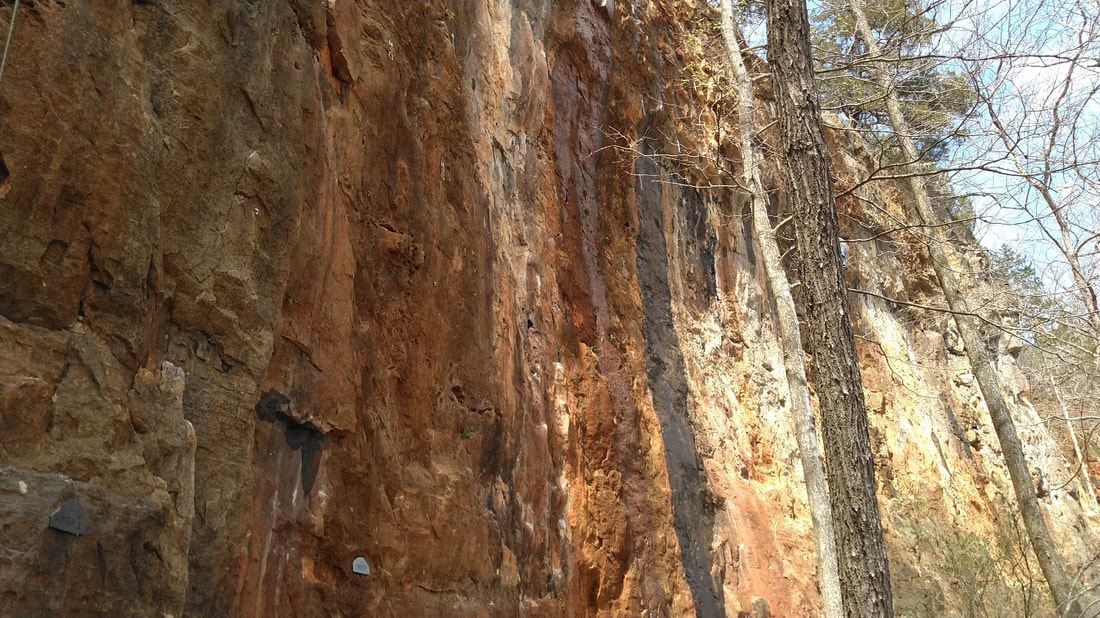
 Vertical Voyages' Jon Richard climbing the Paleozoic-age Potosi Formation. Vertical Voyages' Jon Richard climbing the Paleozoic-age Potosi Formation. Standing like a fortress facing east, Robinson Bluff catches the first rays of morning sunlight. Turkey vultures gather on bare tree limbs to shake off the morning cold. For a moment, nothing moves except for the cold water of the Big River meandering through the valley. Located about an hour from St. Louis, Robinson Bluff feels like a temporal anomaly. On the brochure it states “more climbing, less driving.” Climbers can spend the day choosing from more than 300 routes and still be back in time for dinner. But as the mist lingers on the river and light slowly spills into the valley, time stands still. In this stillness, a greater appreciation of the unique geological past of this climber’s haven can be had when pausing to contemplate how time and change has affected everything around you. Plus, it is shaping up to be a beautiful day to climb. Earth has a long history, spanning approximately 4.6 billion years. At Robinson Bluff, the story begins over 500 million years ago on the bottom of the sea floor. Today, the bluff may be crawling with climbers, but back in geologic time when these rocks were deposited, this area, now known as southeast Missouri, would have been covered by a tropical sea teeming with marine life. The Paleozoic Era The Cambrian Period was significant for many reasons. It marked the beginning of a new era in geologic time called the Paleozoic Era, meaning “ancient life.” Geologists sometimes refer to this period as the “Cambrian Explosion” because it is the time in earth’s history when nearly all major animal phyla appeared in the fossil record. Clues of this “biological big bang” can be found in Missouri’s rock record too. Remains of creatures such as trilobites, stromatolites and crinoids are just a few of the examples. The Paleozoic Era lasted for approximately 289 million years and ended with the biggest mass-extinction event in earth’s history, called the “Great Dying,” when about 90 percent of life in the oceans and 70 percent of life on land was wiped out. Geologists often say that “the present is the key to the past.” In late Cambrian time, several key factors came together to form the rocks at Robinson Bluff. For one, Missouri was a lot closer to the equator then. Warm, crystal-clear water covered most of the state which made Missouri more like the modern-day Caribbean. In the Bahamas today, the conditions are perfect for marine life. Millions of critters live out their days extracting calcium carbonate (CaCO3) from sea water to make the hard parts of their shells. Eventually, when the animals die, their remains sink to the sea floor where they collect in great numbers. Year after year, this cycle continues, forming what geologists refer to as the "carbonate factory.” Similarly, in the Cambrian Period, southeastern Missouri was host to a plethora of newly arrived marine critters. Over vast stretches of time, shell material from these animals accumulated in significant enough proportions and were buried so deeply that they eventually became lithified into the layers of rock we see today. It may be the last thing on a climber’s mind while ascending the route of choice, but Robinson Bluff is a Paleozoic graveyard. Over a hundred and twenty years ago, a geologist named Arthur Winslow trekked through the town of Potosi, Missouri while mapping lead and zinc deposits in the region. He noted a particular bluff-forming rock layer that was easy to identify due to its abundance of mineral blossom deposits, AKA quartz crystals. Using the name of the nearest town, Winslow mapped the geologic formation as the Potosi Dolomite. While they are both carbonates, dolomite is the magnesium-rich cousin of calcite. Calcite and dolomite are minerals that form the rocks limestone and dolostone. Calcite is to limestone as dolomite is to dolostone. Both rock types form in marine environments similar to that of the Bahamas. However, they are chemically different. Like most Paleozoic dolostones in Missouri, the Potosi Formation is believed to have been formed as a limestone that was later exposed to magnesium-rich waters and turned to dolostone. This dolomitization process yields an end product slightly harder than limestone, but for the most part, they look the same. Limestone and dolostone can also be differentiated with a drop of hydrochloric acid (HCl) on the rock surface. While limestone has a vigorous bubbling reaction, dolostone has a very feeble reaction, if any. Perhaps the single most diagnostic feature of the Potosi Formation is the abundance of druse quartz. Appearing about four bolts up from the trail surface on nearly every climb at Robinson Bluff are intriguing mineral clusters that line pockets in the rocks. Hard, crystalline druse quartz creates the sparkling, textured holds that are commonly found throughout the Potosi Formation that resemble the inside of a geode. It also weathers out of deep red, rather sticky clay, locally termed “tallow clay” or “terra rosa,” and can be found on the trails in the vicinity. Quartz is made of silica, or (SiO2), and is a much harder substance than its dolostone host rock. Those who have bolted at Robinson Bluff may have noticed that the upper half of the cliff is harder to drill. This is most likely due to the increase of silica content in the rock. Quartz is a seven on the Moh's Hardness Scale, a scale that geologists use to characterize scratch resistance of various natural materials relative to each other. The mineral calcite is a three on the hardness scale, and dolomite, which makes up most of Robinson Bluff, is three-and-a-half to four on the scale. Drilling through the rock here is a great way to become acquainted with the Potosi Formation and all its chemical nuances. The Mesozoic Era The end of one era is the beginning of another. The Paleozoic Era gave way to the Mesozoic, when all land masses had joined together like a global puzzle to form a supercontinent called Pangaea. This continental crash left an epic mark on the story of Robinson Bluff. About 280-230 million years ago, South and North America slowly collided to form a mountain range resembling the modern Rockies. This event is called the Ouachita orogeny. By the close of the Paleozoic, the Ouachita Mountains in Arkansas and the Wichita Mountains in Oklahoma were newly formed. The vast warm seas of the Paleozoic Era, that had covered Missouri slowly drained away. Today, these mountains still exist, but have weathered away to the roots. Oddly enough, the Ozark Plateaus now exhibit greater relief relative to the Ouachita Mountains that originally pushed them up. This continental collision helped shape the Ozark Region. During the Ouachita orogeny, the land surface was regionally uplifted to form the Ozark Dome. Granites, usually found deep beneath the Earth's surface, were exposed and weathered to reveal the very basement of the continent. On the southeast portion of the geological map of Missouri is a big red bullseye. This marks the core of the Ozark Dome; an igneous province called the St. Francois Mountains. Paleozoic sedimentary rocks encircle the St. Francois Mountains and dip away in all directions from the core. Faults crisscross the region and fractures in the rock became conduits for chemically rich fluids that precipitated all manner of valuable ore minerals, making Missouri one of the most historic mining districts in the country. Most major mountain ranges are associated with a plateau, which is a flat, elevated landform that rises above the surrounding area — the Rockies and the Colorado Plateau, for example. Although the deep valleys and rugged hills of the Ozarks feel like mountains at times, the Ozarks are technically three geologically different plateau surfaces, highly dissected by streams. Robinson Bluff is situated on the Salem Plateau, hosting the oldest-aged rocks of the three. Newton's Third Law of Motion states that for every action in nature there is an equal and opposite reaction. As the land surface was uplifted during the Ouachita orogeny, streams were working hard to erode downward to reach base level. Much of the landscape we see today in the Ozarks was formed by the action of streams reworking earth's surface by cutting through the bedrock. By the end of the Mesozoic Era, Pangaea broke apart and another mass extinction event swept the globe, ending the era of dinosaurs and giving way to the Cenozoic Era, what we consider to be recent life. The Big River, which is the largest tributary stream to the Meramec River, flows north from the core of the Ozark Dome, cutting through the sedimentary rock layers and exposing the majestic cliffs at Robinson Bluff. Water continues to play a major role in weathering the rocks at Robinson Bluff. Groundwater also plays a role in shaping the landscape and creating karst features in carbonate sedimentary rock. The entrance of River Bend Cave emerges near the base of the staircase. Closed to the public, this cave passage extends several hundred feet into the rock and is home to many interesting cave features. After a hard rain, watch for springs pouring from the rock near the cave entrance. Springtime at Robinson Bluff Our journey through geologic time brings us to springtime at Robinson Bluff. On a sunny afternoon in late March, bloodroot flowers are just opening their petals, and in a few weeks, the leaves will unfurl. Climbers, whether or not they realize it, are similar to geologists. Though they use a different vocabulary for the rocks, they make similar observations.
From the bottom of the seafloor to towering bluffs, from ancient oceans to Ozark streams, time and change are everything at Robinson Bluff. James Hutton, the father of geology once said, "It's the little causes, long continued, which are considered as bringing about the greatest changes on earth." Each trip to Robinson Bluff is a chance to learn and discover something new. This incredible geologic and recreational resource has something to offer everyone.
5 Comments
Mike
9/8/2022 09:27:41 am
This was a really neat read! Thank you for taking the time to research and write it.
Reply
Jeffrey Smith
9/8/2022 10:49:19 am
Thanks. That was a pretty informative read. The silica content section really made a lot of sense especially with the old silica mines in Festus being so close.
Reply
Tyler
9/8/2022 07:20:23 pm
I’ve climbed here three times. Then I had to quit climbing to raise my babygirl. I’ll be getting back out this fall God willing and can’t wait to bring my wife and daughter to camp.
Reply
Paul Bartholomew
9/13/2022 03:01:02 pm
Terrific, informative and well-written article - thank you, Ms. Doer!
Reply
Philip Wire
3/23/2024 06:50:19 pm
What an amazingly helpful article. Thank you!
Reply
Leave a Reply. |
Archives
October 2022
Categories |


 RSS Feed